Shipping
Shipping costs are not included in the prices. We will send you a separate email to confirm the shipping fee, which depends on your location and the package size.
Examples: Finland 6,00€; Sweden, Germany, Baltics 10,00€; Benelux, Denmark, Spain 12,00€; Non-EU 35,00€
terms & conditions
Before ordering we kindly ask you to read our terms and conditions.
availability
Our online selection is stored separately. To view an item at the bookstore, please contact us ahead of your visit.
Homann Erbern: Plan des Castels Cronslot
€800,00
Out of stock
Description
Homann Erbern (Homann heirs – Homann heredum)
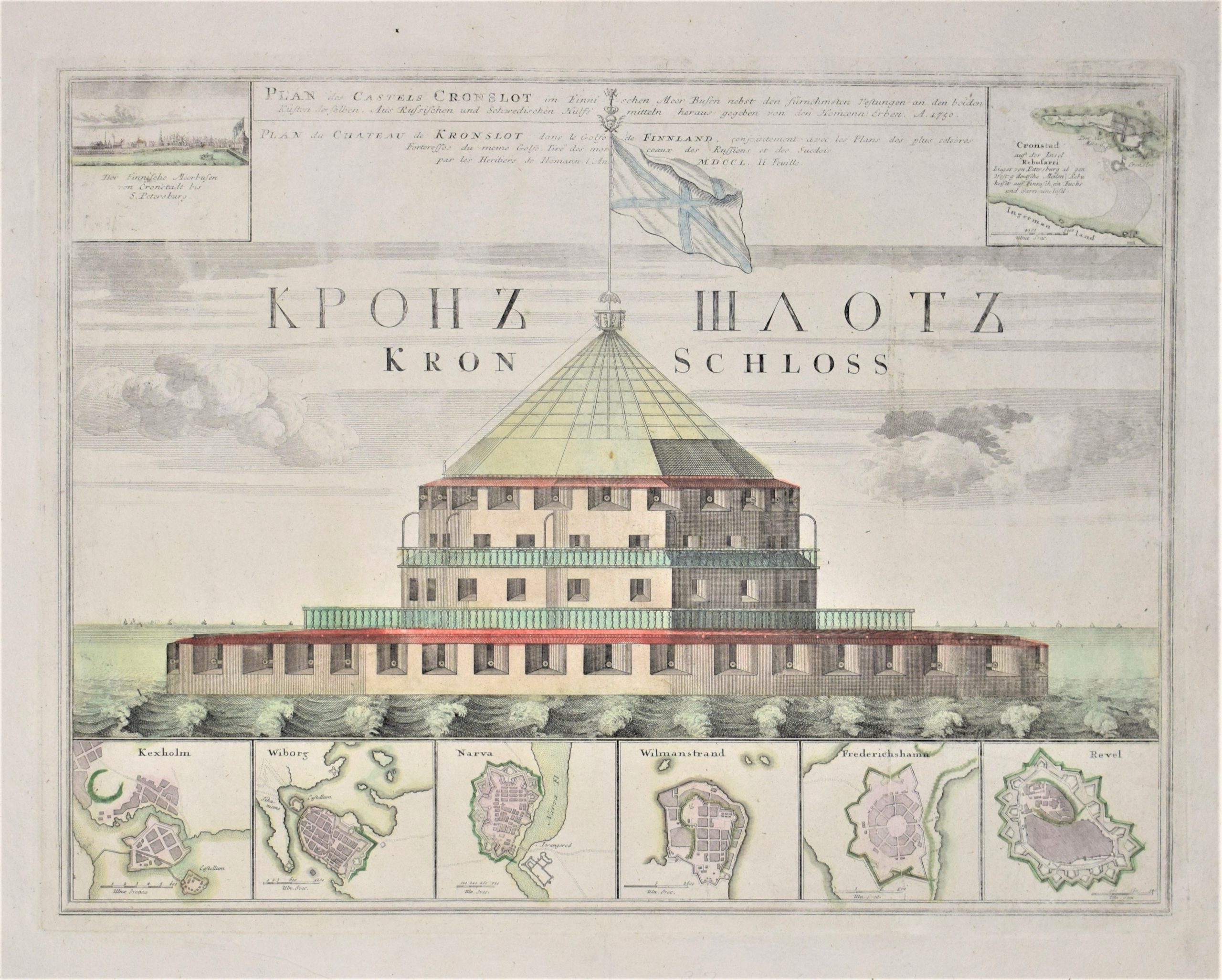
Plan des Castels Cronslot im Finnischen Meer Busen nebst den fürnehmsten Festungen an den beiden Küsten derselben
Mid-18th century chart of Kronstadt fortress in front of St. Petersburg.
Six insert maps: Käkisalmi (Kexholm), Vyborg (Wiborg), Narva, Lappeenranta (Wilmanstrand), Hamina (Friedrichshamn) and Tallinn (Revel).
Also a city view of St. Petersburg in the upper left corner and small scale map of the island of Kronstadt in the right corner.
Hand-coloured copper engraving. Condition of the map is good but the colour is somewhat faded.
| Year of printing | 1750 |
|---|---|
| Illustrations | käsin väritetty / handkolorerade / hand coloured |
| Dimensions | 42 x 55 cm |
| Condition | 3 |
| Condition explanations | (5) Mint, (4) Very good, (3) Good, (2) Fair, (1) Poor |
| Other | – |
Additional information


